Transforming Farming & Agriculture with Drone Technology

In the ever-evolving field of agriculture, staying ahead of the curve is key to maintaining efficiency and maximizing crop yields. Drones equipped with advanced technology provide farmers and agricultural professionals with valuable insights that improve productivity, optimize operations, and enhance decision-making. By utilizing high-resolution imaging, real-time data collection, and aerial mapping, drone technology offers a transformative solution for modern farming practices.
Precision Farming Solutions/Services
- What story can we write about your farm?
What is it/ Who is it for?
We use drones to add value to collect data about your farming operations. We can record and monitor supply quantities, volumes, field and pasture acreages, surface slopes, field and individual plant health. We use the information to help aid those you are already working with -
-We aid you the Farmer with information about every inch of your farm.
-We aid Seed Reps in Stand Count and decisions on replant
-We aid Equipment dealers in Planted vs. expected planting
-We aid Agronomists with plant health - nutrient deficiencies, disease, pests, and insects
-We aid Insurance companies in recording the extent of field damage.
-We aid Spray Applicators by providing heat maps for spot spraying, variable rate spraying and field boundary creation.
Services-
Field Mapping and Crop Monitoring (individual pricing)
-
Mapping
-
OrthoMosaics, Terrain Model, Field Edge boundaries (provide image)
-
Contour Maps (provide image)
-
Digital Terrain Models
-
Field Edge Boundaries (provide image)
-
Plant Health Heat Map (provide image)
-
-
Field Solutions/ What we monitor-
-
Stand Count, Weed Detection,Plant Vigor, Canopy Cover, Waterlog Detection, Lodging Detection, Green Snap
-
Deliverables:
We deliver your field analysis in a number of ways. We share through downloadable Reports, Sharable links to online Data, Variable Rate Spray Maps for field applications, or link to MyJohnDeere Accounts to share field boundaries and map data.
Precision Aerial Applications:
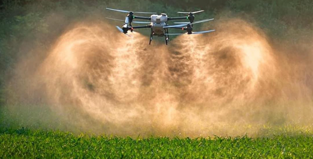
Our drone pesticide, fertilizer, and cover crop application services in Wisconsin provide a safe and efficient way to protect your crops from pests, diseases, and nutrient deficiencies. Our experienced flight team uses state-of-the-art technology and field heat maps(if Variable rate Spraying) to ensure accurate and effective application, reducing the risk of overuse and minimizing environmental impact.
With VectorAg services you can save time and ensure the health and productivity of your crops. Contact (FYI Link to Project Details Form) us today to learn more about how our drone application services can benefit your farm. Working with your seed rep, or agronomist you can trust us to provide the best solution for your protection needs.
Average Prices:
Ag Drone Pesticide Application (Spraying in 2026) ($18-25/acre)
Ag Fertilizer Application (Liquid - approx $15-25/acres),(Dry $25-40/ acre)
Ag Cover Crop Application (approx. $25-35/acre)


